Netherlands Volcanoes
Netherlands has 2 Holocene volcanoes. Note that as a scientific organization we provide these listings for informational purposes only, with no international legal or policy implications. Volcanoes will be included on this list if they are within the boundaries of a country, on a shared boundary or area, in a remote territory, or within a maritime Exclusive Economic Zone. Bolded volcanoes have erupted within the past 20 years. Suggestions and data updates are always welcome ().
Chronological listing of known Holocene eruptions (confirmed or uncertain) from volcanoes in Netherlands. Bolded eruptions indicate continuing activity.
| Volcano Name | Start Date | Stop Date | Certainty | VEI | Evidence |
|---|---|---|---|---|---|
| Saba | 1640 (in or before) | Unknown | Confirmed | Observations: Reported | |
| The Quill | 0250 ± 150 years | Unknown | Confirmed | Isotopic: 14C (uncalibrated) | |
| The Quill | 0550 BCE (?) | Unknown | Confirmed | Isotopic: 14C (uncalibrated) | |
| The Quill | 6140 BCE ± 200 years | Unknown | Confirmed | 4 | Isotopic: 14C (uncalibrated) |
Netherlands has 1 Pleistocene volcanoes. Note that as a scientific organization we provide these listings for informational purposes only, with no international legal or policy implications. Volcanoes will be included on this list if they are within the boundaries of a country, on a shared boundary or area, in a remote territory, or within a maritime Exclusive Economic Zone. Suggestions and data updates are always welcome ().
| Volcano Name | Volcanic Province | Primary Volcano Type |
|---|---|---|
| Northern Centres | Lesser Antilles Volcanic Arc | Composite |
There are 2 photos available for volcanoes in Netherlands.
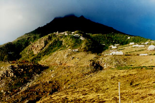
 Mt. Scenery, the summit lava dome of Saba volcano, is seen from the airport on the NE side of the island. The sun-dappled slopes in the foreground are the surface of a large andesitic lava flow that descends the NE flank of the volcano and forms the Flat Point Peninsula, on which the airport was constructed. A steep switch-backed road extends from the airport to the village of Lower Hells Gate (center). Saba is the northernmost active volcano of the West Indies.
Photo by John Shepherd, 2000 (Seismic Research Unit, University of West Indies).
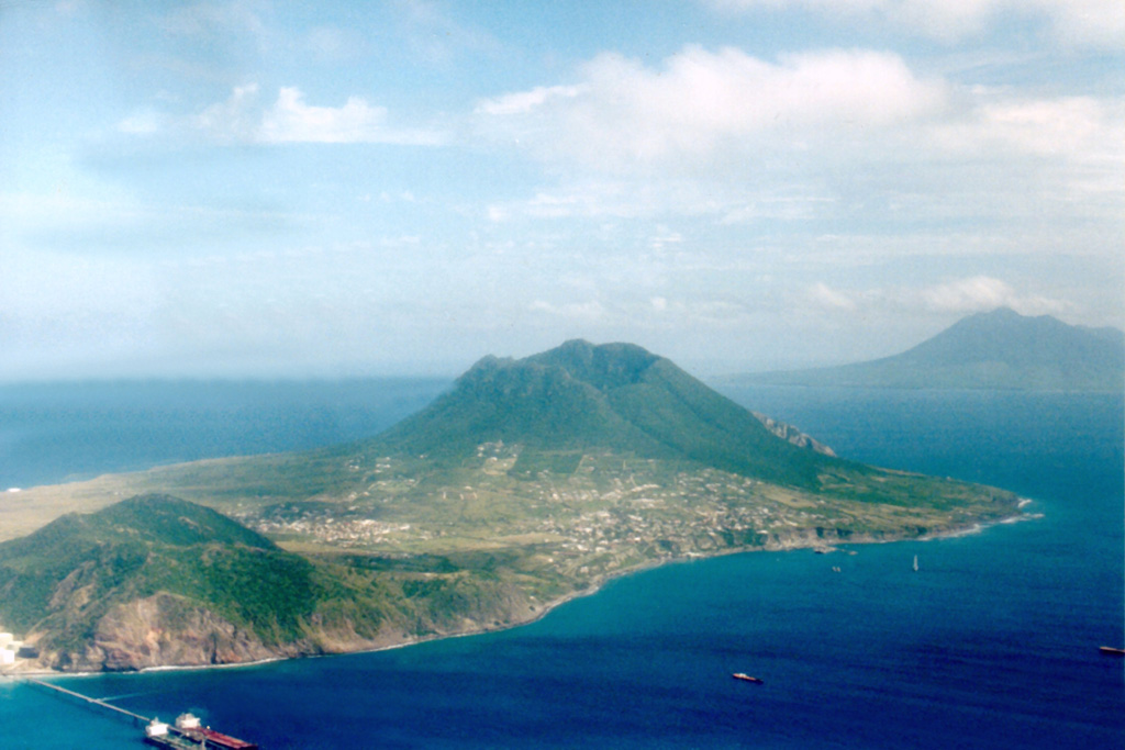
 The Quill stratovolcano (center) forms the SE end of Statia (St. Eustatius) Island. Pleistocene volcanic rocks form the hill at the lower left, and Mount Liamuiga volcano on St. Kitts (St. Christopher) Island rises across the strait at the right center. A steep-sided 760-m-wide crater truncates the summit of The Quill, which was formed about 32,000-22,000 years ago by rhyolitic eruptions on a shallow-water limestone bank. Pyroclastic-flow and -surge deposits, the last of which were erupted about 400 CE, blanket the slopes of the volcano.
 Photo by John Shepherd, 2000 (Seismic Research Unit, University of West Indies).
This is a compilation of Netherlands volcano information sources, such as official monitoring or other government agencies.
| Volcanic Ash Advisory Center | |
|---|---|
| Toulouse Volcanic Ash Advisory Center (VAAC) Notices and Archive | |

